Picture ID: 508
Gelinkt aan gebeurtenis: 738, Analyse van James F. Miller van het hoofdwondincident bij MvR.
Source ID: 61
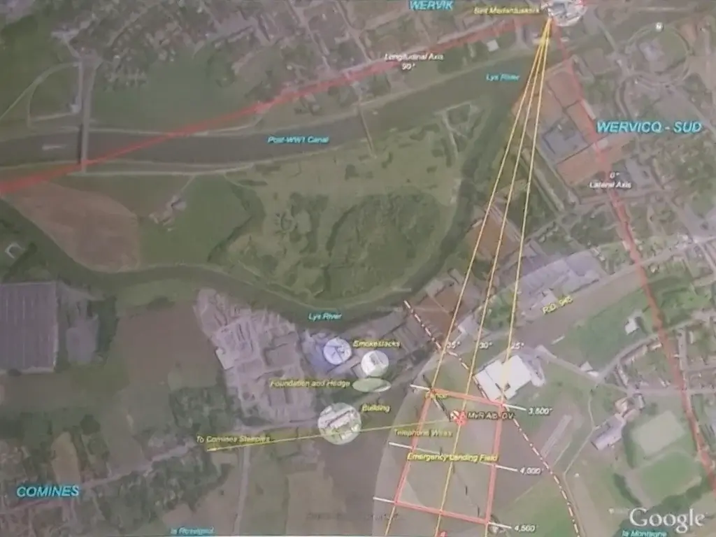
Bijschrift in bron:
A modern aerial view of Richthofen's landing site in Comines, France. The 14th-century church Sint Medarduskerk is visible at upper right. La Montagne is lower right at the center of a highlighted circular area that depicts the 1 km radius within which Hans Schröder estimated the emergency landing field was located from his observation post. Points "a", "b" and "c" depict locations from which photos of Richthofen's downed Albatros were taken in 1917, "d" depicts the locations from which a view of the landing ground was taken in 2004, (underlying geographic image courtesy of Google Earth) (picture source: Inside the victories of Manfred von richthofen - Volume 1, James F. Miller, Aeronaut Books, 2016)


Comments (0)